
Point Cloud Density
Point cloud density is a core quantitative metric in industrial 3D scanning that describes the number of 3D coordinate points (part of a point cloud.
Definition
Point cloud density is a core quantitative metric in industrial 3D scanning that describes the number of 3D coordinate points (part of a point cloud dataset) captured per unit area or unit volume of a scanned physical object. It directly correlates to the level of surface detail that can be extracted from the point cloud, and is a key consideration when configuring scanning workflows for industrial use cases ranging from reverse engineering to dimensional metrology.
How It Works
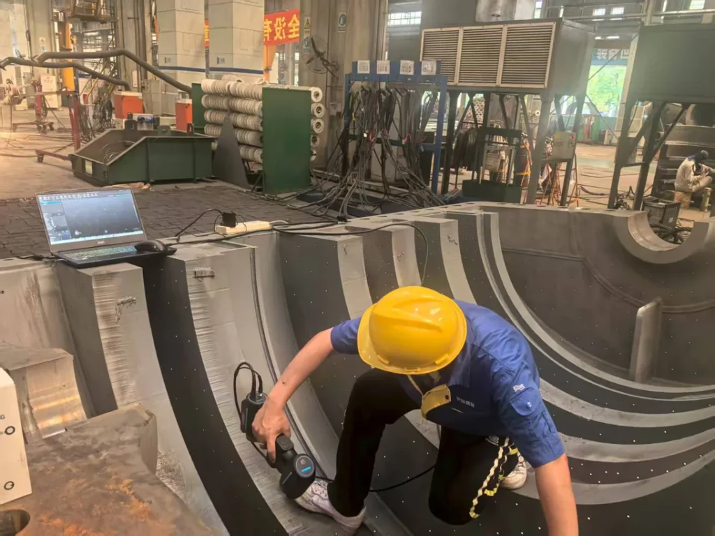
Point cloud density is determined by a combination of hardware, software, and environmental factors during the scanning process, and can be modified during post-processing. For structured light 3D scanners, density is primarily influenced by the resolution of the projected light pattern and the resolution and number of imaging cameras used to capture distorted light patterns. Each captured frame is processed to triangulate 3D coordinates for points across the object surface, with higher-resolution hardware generating more points per unit area. For laser 3D scanners, density is tied to the number of projected laser lines, laser sampling frequency, and camera frame rate. For example, scanners using 50-beam cross blue laser configurations generate more sampling points per pass than single-line laser systems, increasing native density. Optical tracking systems used for large-volume scanning also impact density consistency, as they ensure scan frame alignment across large surfaces to avoid gaps or uneven point distribution. During post-processing, density can be reduced via decimation (removal of redundant points) or increased via upsampling (interpolation of synthetic points), though upsampling does not add new measured surface detail.
Key Parameters and Criteria
Acceptable density thresholds are entirely use case dependent: for example, high-precision reverse engineering of complex industrial workpieces requires far higher density than large-scale facility layout scanning. The following measurable parameters are used to evaluate point cloud density performance:
| Parameter | Meaning | Judgment Method |
|---|---|---|
| Nominal Point Density | The theoretical maximum number of 3D points generated per unit area (points/mm²) or volume (points/cm³) under ideal calibrated scanning conditions, based on scanner hardware specifications. | Calculate by dividing the total valid point count captured on a flat, matte reference surface of known area, using scanner settings optimized for maximum detail capture. |
| Point Spacing Consistency | The degree of uniformity in the distance between adjacent points across the entire point cloud, with minimal variation between flat surfaces, curved edges, and recessed features. | Measure the standard deviation of point-to-point distances across 10+ randomly sampled 1cm² regions of the cleaned point cloud; lower standard deviation indicates higher consistency. |
| Effective Working Density | The actual point density achieved on a target object under real-world scanning conditions, accounting for surface properties, object geometry, and environmental interference. | Divide the total valid point count of the cleaned target point cloud by the measured surface area of the physical object, excluding outlier and noise points removed during preprocessing. |
| Post-Processing Density Adjustment Fidelity | The degree to which point density can be modified (reduced via decimation or increased via upsampling) without compromising the accuracy of critical geometric features (edges, holes, curved surfaces). | Compare dimensional measurements of key features in the adjusted point cloud against measurements from the raw high-fidelity scan; acceptable fidelity is achieved when measurements remain within the use case's required tolerance thresholds. |
Suitable and Unsuitable Scenarios
Suitable Scenarios for High Point Cloud Density
- High-precision reverse engineering of complex industrial workpieces, where micron-level surface details, fine tool marks, or intricate geometric features must be replicated.
- Dimensional metrology and tolerance analysis for high-precision components, where small features such as assembly holes, seal surfaces, or contact points require accurate measurement.
- Wear and damage inspection for industrial parts (e.g., turbine blades, mold cavities), where micro-cracks, abrasion patterns, or deformation must be detected at sub-millimeter scales.
- 3D modeling for additive manufacturing, where accurate surface finish and fine feature replication are required for part functionality.
Unsuitable Scenarios for Excessively High Point Cloud Density
- Large-volume site or structural scanning where only overall dimensional layout or rough geometric alignment is required, as high density produces excessively large file sizes that slow processing and increase storage costs.
- Preliminary prototyping fit checks where only gross dimensional conformity is needed, as excess density adds no analytical value and extends workflow duration.
- Low-latency dynamic scanning workflows, such as real-time part alignment or robotic path guidance, where processing speed is prioritized over ultra-fine surface detail.
Common Misconceptions
- Higher point cloud density is always preferable
This is incorrect. While higher density enables finer detail capture, it also increases scan time, point cloud file size, and post-processing computational requirements. Excess density may also capture irrelevant surface noise (e.g., dust, minor surface blemishes) that complicates analysis. Optimal density is matched to the specific use case's feature resolution requirements.
- A scanner's advertised maximum density is achievable on all objects
Advertised maximum density is measured under ideal conditions (matte, flat, high-contrast reference surfaces in controlled environments). Real-world effective density is reduced by factors including high surface reflectivity, dark or low-contrast surfaces, steep object angles, and recessed features that limit light or laser access.
- Upsampling a low-density point cloud produces equivalent quality to a natively captured high-density cloud
Upsampling uses algorithmic interpolation to add synthetic points between existing captured points, but does not generate new measured data about the object's physical surface. As a result, upsampled clouds cannot replicate fine surface details or improve measurement accuracy in the same way as natively captured high-density data.
- Point cloud density is equivalent to 3D scanning accuracy
Density describes the packing of 3D points, while accuracy describes how closely each point's measured coordinate matches the object's true physical position. A high-density point cloud can have low accuracy if the scanner has calibration errors, while a low-density cloud can be highly accurate if each captured point is precisely measured. The two metrics are independent, though both are often prioritized for high-precision use cases.
Related Concepts
- 3D Scanning Accuracy: A core metric describing the degree of conformance between a point's measured 3D coordinate and its true physical value, independent of density but often paired with high density for high-precision industrial applications.
- Point Cloud Data: The collective set of 3D coordinate points (often augmented with attributes like surface reflectivity or color) generated by 3D scanning, of which density is a defining characteristic.
- Structured Light 3D Scanning: A scanning modality that uses projected patterned light (from devices such as the INSVISION Alpha-Projector) to generate 3D point clouds, with native density tied to projector resolution and camera sensor specifications.
- Laser 3D Scanning: A scanning modality that uses projected laser lines to capture 3D surface data; configurations with multiple cross-aligned laser lines (e.g., 50-beam cross blue laser systems used in some handheld industrial scanners) generate higher native density per scan pass than single-line systems.
- Point Cloud Decimation: A post-processing step that reduces point cloud density by removing redundant points, optimizing file size and processing speed while preserving critical geometric features.
- Optical Tracking Systems: Systems used to align scan frames across large-volume scanning workflows, ensuring consistent point density distribution across large objects without gaps or uneven sampling.
FAQ
How do I select the appropriate point cloud density for my industrial use case?
Optimal density is determined by three core factors: the size of the smallest geometric feature you need to capture or measure, the required measurement tolerance for your use case, and the computational resources available for point cloud processing and storage. As a general guideline, select a density where the average point spacing is 3 to 5 times smaller than the smallest feature you need to resolve to ensure accurate feature representation. Avoid selecting higher density than required to prevent unnecessary workflow delays and increased storage costs.
Can point cloud density be modified after scanning is complete?
Yes, point cloud density can be adjusted during post-processing. Density can be reduced via decimation, a process that removes redundant points while preserving critical geometric features, to reduce file size for applications where fine detail is not required. Density can be increased via upsampling, which uses algorithmic interpolation to add synthetic points between existing captured points, but this process does not add new measured data about the object's physical surface, so it cannot replicate fine details captured natively by high-density scanning.
How does an object's surface properties impact effective point cloud density?
Surface properties directly affect the number of valid 3D points a scanner can capture. High-reflectivity, dark, or low-contrast surfaces may absorb or reflect projected light or laser energy away from the scanner's cameras, reducing the number of valid points generated and lowering effective density. Recessed features or steep surface angles can also limit light or laser access, reducing density in those regions. Specialized scanner settings or permitted surface preparation (e.g., temporary matte sprays) can mitigate these effects.
What is the relationship between point cloud density and scanning workflow speed?
Higher native point density typically requires higher sampling rates from scanner hardware, which can reduce the area or volume that can be scanned per unit time. Additionally, higher-density point clouds require more computational resources for alignment, noise removal, and analysis, extending overall workflow duration. For use cases where speed is a priority, users may opt for lower density settings that still meet their feature capture requirements.
Summary
Point cloud density is a fundamental metric in industrial 3D scanning that quantifies the number of 3D coordinate points captured per unit area or volume of a scanned object, directly impacting the level of surface detail that can be extracted from scan data. It is determined by a combination of scanner hardware capabilities, software configuration, object properties, and scanning environment, with no universal optimal value, as suitability depends entirely on the specific requirements of a given use case. While higher density enables capture of finer geometric details, it must be balanced against workflow tradeoffs including increased scan time, larger file sizes, and extended post-processing duration. Common misconceptions, such as the assumption that higher density is always preferable or that density is equivalent to scanning accuracy, can lead to inefficient workflow design. Understanding point cloud density alongside related metrics like 3D scanning accuracy enables users to configure scanning workflows that meet their industrial application needs effectively.
- What Is 3D Scanning? Principles, Workflow, and Industrial Applications 3D scanning is a digital measurement technology that converts the surface geometry of physical objects into 3D data. This entry covers its working principles, core parameters, industrial use cases, common misconceptions, and related technical…
- What Is a 3D Scanner? Types, Parameters, and Selection Criteria A 3D scanner captures three-dimensional surface data from physical objects and converts geometry, dimensions, and features into digital data for inspection, reverse engineering, and modeling.
- What Is 3D Scanning Accuracy? Accuracy, Repeatability, and Resolution Explained 3D scanning accuracy describes how closely scan data matches an object's actual geometry and dimensions. It is assessed through local accuracy, volumetric accuracy, stitching accuracy, repeatability, and resolution.
- What Is Point Cloud Data? Point Clouds, Meshes, and CAD Models in 3D Scanning Point cloud data is an important raw data format in 3D scanning. It consists of discrete 3D coordinate points that describe object surface geometry and support inspection, reverse engineering, modeling, and archiving.
Hangzhou Insvision Technology Co.,Ltd.
Address: Building 1, No. 1399 Liangmu Road, Yuhang District, Hangzhou, Zhejiang 311121, China